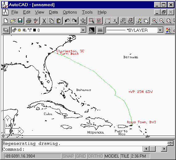
The screen image shows three types of data imported from DXF files into AutoCAD. The coastlines were obtained with GARDYLOO -C2D, the waypoints were obtained with GARDYLOO -W2D50000 and the GPS track was obtained from GARDYLOO -T2D.
Gardyloo converts the entities to the CAD program's X-Y space without any projection transformation. That is, longitude simply becomes the X coordinate, and latitude the Y coordinate. This has the effect of making higher latitude charts appear stretched horizontally. This can be corrected by rotating the CAD program's viewport about the Y axis by an amount equal to the local latitude.
Simple CAD entities consisting of a single polyline can be exported to a DXF file, and converted to a Track file with GARDYLOO - D2T. This is useful for constructing maps and uploading them to a GPS.
|GARDYLOO|
|Track File| |Waypoint
File| |Coastline Data|
|DXF File| |ASR File|
|Speed Data|
Copyright © A. Peter Allan, 2000. All rights reserved.